Cartography learns how to create and use maps. It develops in close unity with physical and economic geography. Cartography as a science is closely connected with cartographic production - the creation of maps, atlases, globes. Currently, cartographic production is based on satellite imagery.
Plan, map, aerial photograph, space photograph
Plan - a drawing of the area, made in conventional symbols and on a large scale (1:5000 or more). The plan is created in the course of direct instrumental, visual or combined surveys on the ground.
Map
Map - a reduced, generalized, symbolic image of the Earth, other planets or the celestial sphere, built according to a mathematical law (that is, scale and projection). A map is a model of reality that shows the location, properties and relationships of natural and socio-economic phenomena. These include maps and atlases.
aerial view
aerial view
aerial view - a photographic image of the earth's surface obtained from an aircraft or from another aircraft.
Aerial photographs are divided into planned - the location of the axis is vertical, perspective - the axis is tilted. Based on the images, the structure of the area, its topography, geological features, road network, vegetation cover, soils, and so on are recognized. Aerial photographs serve as the basis for creating maps of various subjects.
space shot

space shot
space shot - an image of the Earth or other celestial body obtained from a spacecraft. Space images are the main materials of remote sensing. Space images are widely used in all areas of science and economic practice. Cosmophotomaps are created on the basis of cartographic works.
Scale

Map projections
scale
is the ratio of the length of a line on a map to the length of the corresponding line on the globe. The scale shows how many times the cartographic image is reduced. For example 1:100000.
A cartographic projection is a way of moving from a real, geometrically complex earth's surface to a map plane. The general equation of map projections is: x=
Equidistant projections retain the shape of small objects without distortion, but the length and area are sharply deformed in them.
Equal-area projections do not distort areas, but the angles and shapes of objects in them are strongly distorted. Arbitrary projections have distortions of lengths, areas, angles, but they are distributed over the map in the most beneficial way.
Among arbitrary projections, equidistant projections stand out - there is no distortion of lengths in one direction.
For maps, conic projections are usually used, in which an imaginary cone cuts the globe along the parallels of 47 degrees and 62 degrees north latitude. are lines of zero distortion.
Geographical coordinates
- conditional values: latitude and longitude, which determine the position of any point relative to the equator and the prime meridian.
Point latitude
called the angle between the plane and the plumb line at a given point.
longitude called the linear angle of the dihedral angle formed by the plane of the initial meridian and the plane of the meridian passing through the given point.
Symbol system.
Types of conventional signs

Symbol system
familiarity
- one of key features any map, something that distinguishes it from many other sources of geographic information.
There are several types of symbols. Scale or contour symbols convey the actual dimensions of the object, which are expressed on the scale of the map. Non-scale symbols are used for objects that are not expressed on the scale of the map ( settlements). Linear signs convey linear objects on the maps: rivers, roads.
In addition, there are explanatory signs on the map: arrows indicating currents, as well as signatures, letters and numbers.
Icons are used for objects, localized points or not expressed on the map scale.
Linear signs
are used for objects localized on lines. The qualitative background reflects the zoning of the territory according to some attribute.
Contours
- lines of equal values of any quantitative indicator are used to show phenomena that have a continuous, continuous and smooth distribution.
Localized and charts
- diagrams tied to certain points, but at the same time characterizing these points and adjacent territories.
Habitat method
is used to highlight on the map areas of distribution of any homogeneous phenomena or objects (minerals).
Point method
used for the scattered distribution of objects unevenly distributed over large areas. Each dot represents a certain number of objects.
Movement signs convey the movement of a phenomenon in space, such as the direction of winds and currents.
Cartograms.
They are used to display absolute statistical indicators for cells of territorial division, for example, volume industrial products by region.
Cartograms. They characterize relatively statistical indicators for cells of territorial division, for example, the volume of production per capita. For map charts, a scale is required, and the saturation of light clearly conveys the intensity of the displayed phenomenon.
Ways of depicting the phenomenon.
The main way to depict the relief is horizontal, i.e. lines connecting points with the same absolute height. The detail of the image depends on the height of the relief section, i.e., on the difference in the heights of adjacent contour lines. Depth lines are called isobaths. The method of contour lines and isobaths is used to show the diversity of the relief. It allows you to easily determine the absolute height (above sea level) or relative height (the excess of one point above another) at any point on the map. To give the relief even more expressiveness, the method of shadow plasticity, or hillshade, is used, that is, it is covered with shadows.
cartographic generalization.
Cartographic generalization
- selection and generalization of the objects depicted on the maps, highlighting their main typical features and features.
The theme of the maps also affects the generalization. If a geological map is created, then the road network is usually strongly generalized on it. The impact on the generalization of the features of the mapped territory is manifested in the fact that the maps convey the most characteristic elements of the territory.
Types of generalization.
There are different types of generalization. First of all, this is the selection of objects shown on the map. Larger objects are left on it (rivers longer than 1 cm on a map scale, settlements with a population of more than 10 thousand people), and those objects that are smaller than these values are called selection qualifications.
The generalization of a quantitative characteristic is associated with the introduction of larger quantitative units, an increase in gradations, intervals, scales, etc.
Generalization qualitative characteristics manifests itself in the reduction of qualitative subdivisions (instead of signs of coniferous, deciduous, mixed forests, a single forest sign is introduced).
Simplifying object shapes
is the exclusion of small, unimportant configuration details.
Cartographic generalization contributes to the display of qualitatively new information on the map, and this is its important role in geographical knowledge.
Create maps
There are two main methods for creating maps:
- direct shooting on the ground;
- office card making.
To create large-scale topographic maps on the ground, surveys are carried out using geodetic instruments. At the same time, aerial photography is attracted, which makes it possible to obtain an accurate image of local objects.
To compile large-scale geological, soil, and other maps, special types of surveys are involved: geological, soil, etc.
Types and types of geographical maps
Division of maps by scale. In cartography, the following classification of maps by scale is accepted:
- plans - 1:5000 and larger;
- large-scale maps - from 1:10000 to 1:200000;
- medium-scale maps - smaller than 1:200,000 to 1:1,000,000;
- small-scale - smaller than 1:1000000.
Classification of maps by spatial coverage. One of the most commonly used classifications is as follows:
- star charts;
- maps of the planets and the Earth;
- hemispheric maps;
- maps of continents and oceans;
- country maps;
- maps of republics, territories and regions, administrative regions;
- maps of individual territories (reserves, tourist areas, etc.);
- city maps;
- maps of urban areas, etc.
Classification of maps by content.
There are two large groups of maps: general geographical and thematic. General geographic maps display all the geographical elements of the area with equal detail: relief, hydrography, soil and vegetation cover, etc. These maps are divided into topographic (on a scale of 1:100,000 and larger), survey topographic (1:200,000 - 1:1,000,000) and overview (smaller than 1:1,000,000).
second large group make thematic maps. Among thematic maps, two main groups are distinguished: maps of natural phenomena and maps of social phenomena.
Each division contains a large number of different thematic maps, for example, economic maps include maps of the location of individual industries.
It should also be noted maps of border (interdisciplinary) themes, reflecting the close interaction of nature, society and economy.
These are the cards economic evaluation natural resources, agro-climatic, engineering-geological and many others.
Classification of cards by purpose.
The purpose of the cards is as diverse as the spheres of human activity, but some types of cards stand out quite clearly.
Scientific reference maps are designed to carry out scientific research on them and obtain the most detailed information.
Cultural, educational and propaganda cards are intended for the general public. Their goal is to disseminate knowledge, ideas, and expand the cultural horizons of people.
Technical cards display the objects and conditions necessary to solve any technical problem.
Educational cards are used as visual aids or materials for independent work in the study of geography, history, etc.
Tourist cards are intended for tourists and vacationers. They depict objects and places of interest to tourists.
Card types.
Types of maps characterize the breadth of coverage of the topic, the degree of generalization of the mapped phenomena. In modern cartography, it is customary to distinguish three main types of maps:
- analytical, giving an image of individual phenomena without connection with other phenomena (maps of air temperature, precipitation, winds, pressure, which are analytical climate maps);
- complex maps combine the image of several elements of similar topics, a set of characteristics of one phenomenon (one map can show both pressure and winds in the territory);
- synthetic, reflecting the totality of interrelated phenomena as a whole.
Geographic atlases.
Atlases
- these are systematic, integral collections of maps created according to a single program.
(From the 6th grade geography course, remember who first created the atlas)
The classification of atlases according to their purpose is of the greatest practical importance.
Reference atlases
- these are usually general geographic and political-administrative atlases that convey general geographical objects in the most detail: settlements, relief, road network.
Comprehensive scientific reference atlases
- major cartographic works that provide the most complete, scientifically based and versatile characteristics of the territory.
Popular (local history) atlases
intended for the general reader, they are publicly available and addressed to students studying motherland, tourists and local historians, hunters and fishermen.
Educational atlases
focused on serving the educational process at school, in higher educational institutions.
Travel and travel atlases
designed to meet the needs of tourists, athletes, motorists, travelers.
Use of cards. Working with cards.
Directions of use. AT modern society maps, atlases and other cartographic works are widely used in the following areas:
- for orientation on the ground;
- in modern navigation systems;
- in science, as a means of obtaining knowledge about the object under study;
- in national economy in planning, engineering construction, exploration of minerals;
- in military affairs to ensure the country's defense capability;
- in learning how study guides and materials for self-study.
Map orientation.
Navigating the terrain on the map means:
- identify on it the surrounding local objects and relief,
- determine the direction of the sides of the horizon and establish your location.
Determining the distance when moving on a topographic map can be done in different ways:
- visual assessment (during training, a distance of up to 1 km can be determined with an accuracy of about 10%);
- measuring steps between two landmarks, knowing the length of a step or a pair of steps;
- calculation by time and average speed.
Definition of directions.

It is carried out using a compass. The angle counted clockwise from the north end of the compass needle to the direction of the local object is called magnetic azimuth. It can take values from 0° to 360°. Knowing the magnetic azimuth, you can plot the direction on a topographic map by setting aside the azimuth value from the geographic meridian using a protractor. In this case, it is necessary to introduce a correction for the deviation of the magnetic azimuth from the true one.
Working with cards:

One of the easier ways to work with maps is geographical descriptions .
Descriptions are general and private . General descriptions give a comprehensive description of the nature, population, economy of the territory, and private - relate to any one component, for example, relief or features of settlement.
Descriptions of the cards should be logical, orderly, consistent. In a comprehensive description of the territory, adhere to next plan: geographical location, relief, hydrography, climate, soils and vegetation, landscapes, population, industry, agriculture, economic regions.
Compilation of profiles.
Profiles are built in order to present a vertical section of the phenomenon under study along the direction chosen on the map. This may be a relief profile, geological or soil sections, temperature curves, density profiles, etc., so semetric profiles usually serve as the basis for other natural profiles. On complex profiles, several phenomena are shown simultaneously one above the other. When constructing profiles, two axes are set, distances are plotted along the horizontal, usually on a map scale, and along the vertical - the values of the profiled indicators.


Cartometric definitions.

Measurements of the lengths of straight lines are performed with a compass and a scale ruler, and broken lines are measured in segments. To measure the winding lines of rivers, coastlines, etc., you can use a measuring compass with a small opening of needles, with which they “pass” along the measured winding line and then multiply the number of “steps” by the opening value expressed on the scale of the map. Winding lines can also be measured with a device such as a curvimeter. It consists of a moving wheel and a dial with an arrow that indicates the distance traveled on the map in cm or km on the ground.

Measurement of areas is carried out using planimeters.
The principle of operation of the device is based on measuring the lengths of arcs described on the surface by a special roller with a very small contact patch. The roller is fixed on one of the pivotally connected levers of the simplest pantographic mechanism. The known position of the roller relative to the links of the mechanism allows, when bypassing the measured contour with the measuring pin of the pantograph - by rolling the roller at each specific moment of time along an arc with a strictly defined radius - to approximate the measured contour with a rectangle with a known side length and an area equal to the area of the measured contour. Palettes - transparent overlays on the map, drawn into squares of the same size (for example, the area of \u200b\u200bone square is 1 sq.cm). The area is found by the formula P=a2 n, where a is the side of the square, expressed in km, and n is the number of squares that fall within the measured contour.
Tasks for the chapter.
Tasks "Open the atlas."
- Reveal on the maps the relationship between the geological structure of the territory, its relief, soils, vegetation, and other elements of the landscape. Using thematic maps, to determine the relationship between natural factors and the economic characteristics of the territory, the nature of the distribution of the population, and the direction of nature management.
- Create a profile on a topographic map. Build a complex profile on a series of thematic maps of the atlas, for example, along the meridian.
- Write a description of the area on the topographic map.
- Give a comprehensive description of the territory according to a series of physical-geographical or economic maps of the atlas. Indicate the position of the territory, its length, the main natural features, the nature of the distribution of the population, the most important features of economic development. Supplement the description with quantitative information from the maps.
Questions for the chapter
- Arrange the cities listed below in order of decreasing altitude. Write down the resulting sequence of letters in response. A) New York B) Ulaanbaatar C) Moscow
- Determine which millionaire city in Russia has geographical coordinates 56 ° N. latitude, 44° E
- Determine on the map the distance on the ground in a straight line from the spring to the church. Measure between the centers of conventional signs. Round the result to the nearest tens of meters. Write the answer as a number. FIGURE
- Determine on the map in which direction the spring is located from the tower.
- A farmer chooses a site for laying a new orchard. He needs a site where the snow melts early in the spring, and in the summer the soil is best warmed by the sun. It must also have a location that is convenient for the export of the harvested crop to the cannery. Determine which of the sites indicated on the map by numbers 1,2 and 3 most of all meets the specified requirements. Give two reasons to support your answer.
- The figures show the terrain profiles built on the basis of the map along the A-B line by different students. Which of the profiles is built correctly? PICTURE
- Analyze the climate and the diagram and determine which letter on the map indicates the point whose climate is shown on the climate diagram. PICTURE
”, created with the support of NASA, astronauts on the ISS are shooting the planet from low Earth orbit. To date, they have taken over 1.8 million pictures. You can view 12 collections on the Portal website: Earth Observatory, Glaciers, Volcanoes, Craters, Pictures of Natural Disasters, Time Lapse Video, Photos of World Capitals, Life at the Station , "infrared images". In the historical collection, you can see photographs of the entire Earth, the transit of Venus across the disk of the Sun in 2012, and night shots of the planet. The earliest materials from the archive came from the Mercury space program in the early 1960s.
One of the archive's most interesting tools is the Earth Observation System, which broadcasts HD images from several cameras installed on the ISS. On the site, you can also take a test on knowledge of geography "" and see demonstrating individual parts of the Earth or space phenomena.
A team of seven people is working on the project. In the FAQ section, you can ask questions to researchers: how detailed can a picture from space be; what photographic equipment the team uses; why astronauts do not see the North and South Poles and do not have time to photograph the stars.
One of the most common questions is “Can you see the Great Wall of China from space?”. In fact, it cannot be seen with the naked eye, but in the photographs it is visible - the Chinese wall looks like a thread two pixels thick.
("img": "/wp-content/uploads/2015/01/nasa_011.jpg", "alt": "Gateway to Astronaut Photography 01", "text": "Klyuchevskaya Sopka, Kamchatka.")
("img": "/wp-content/uploads/2015/01/nasa_021.jpg", "alt": "Gateway to Astronaut Photography 02", "text": "Siachen Glacier, Himalayas.")
("img": "/wp-content/uploads/2015/01/nasa_031.jpg", "alt": "Gateway to Astronaut Photography 03", "text": "Demavend extinct volcano, Iran.")
("img": "/wp-content/uploads/2015/01/nasa_041.jpg", "alt": "Gateway to Astronaut Photography 04", "text": "View of the Earth from the station.")
("img": "/wp-content/uploads/2015/01/nasa_051.jpg", "alt": "Gateway to Astronaut Photography 05", "text": "Full view of Earth.")
("img": "/wp-content/uploads/2015/01/nasa_061.jpg", "alt": "Gateway to Astronaut Photography 06", "text": "Depth measurement from the International Space Station.")
("img": "/wp-content/uploads/2015/01/nasa_071.jpg", "alt": "Gateway to Astronaut Photography 07", "text": "Both Northern and Southern Hemispheres during the late During the spring and early summer seasons, mesospheric clouds are at the peak of their visibility. Due to their specific brilliance, they are called noctilucent or night-luminous.")
("img": "/wp-content/uploads/2015/01/nasa_081.jpg", "alt": "Gateway to Astronaut Photography 08", "text": "Time for nostalgia. Last flight of the Space Shuttle program in the summer 2011.")
("img": "/wp-content/uploads/2015/01/nasa_091.jpg", "alt": "Gateway to Astronaut Photography 09", "text": "Transit of Venus across the Sun.")
("img": "/wp-content/uploads/2015/01/nasa_101.jpg", "alt": "Gateway to Astronaut Photography 10", "text": "Hurricane Ivan, September 2004.")
("img": "/wp-content/uploads/2015/01/nasa_11.jpg", "alt": "Gateway to Astronaut Photography 11", "text": "Historical image of a stratovolcano.")
("img": "/wp-content/uploads/2015/01/nasa_12.jpg", "alt": "Gateway to Astronaut Photography 12", "text": "Glorieux Islands, Indian Ocean.")
("img": "/wp-content/uploads/2015/01/nasa_13.jpg", "alt": "Gateway to Astronaut Photography 13", "text": "Bouvet Island is an uninhabited volcanic island in the South Atlantic Ocean .")
("img": "/wp-content/uploads/2015/01/nasa_14.jpg", "alt": "Gateway to Astronaut Photography 14", "text": "Italy at night.")
("img": "/wp-content/uploads/2015/01/nasa_15.jpg", "alt": "Gateway to Astronaut Photography 15", "text": "Cities at night.")
("img": "/wp-content/uploads/2015/01/nasa_16.jpg", "alt": "Gateway to Astronaut Photography 16", "text": "Night lights over Russia.")
("img": "/wp-content/uploads/2015/01/nasa_17.jpg", "alt": "Gateway to Astronaut Photography 17", "text": "Two low pressure areas, Northeast Pacific Ocean. ")
("img": "/wp-content/uploads/2015/01/nasa_18.jpg", "alt": "Gateway to Astronaut Photography 18", "text": "Amazon River in sunlight.")
("img": "/wp-content/uploads/2015/01/nasa_19.jpg", "alt": "Gateway to Astronaut Photography 19", "text": "Sahara desert after sunset.")
("img": "/wp-content/uploads/2015/01/nasa_20.jpg", "alt": "Gateway to Astronaut Photography 20", "text": "Tempano Glacier, South Patagonian Ice Plateau.")
Images courtesy of Earth Science and Remote Sensing Unit, Johnson Space Center, NASA.
Class: 6
Lesson Objectives:
Educational: 1.Get to know various types pictures of the Earth and learn to recognize them
Educational: 1. To develop the ability to recognize the studied objects in photographs, analyze and compare them, as well as continue to develop skills in working with a globe
Educational: To promote the formation of an ecological outlook, information competence of students.
Equipment: globe, computer, geoinformation program Google Earth, multimedia projector and parallels.
Lesson methods:
reproductive, practical.
Lesson Forms: conversation, practical work, independent work, individual work, work in pairs.
Lesson type.
Learning new material.
During the classes.
1. Organizing time. (2 minutes)
Hello guys! I am glad to meet you. The topic of our today's lesson: «
Image of the earth's surface on a plane. Aerial and satellite imagery .»
Let's remember what model of our planet we met? (Globe is a reduced three-dimensional model of the Earth). What do we already know? (determine geographic coordinates). Today you will get acquainted with flat images of the Earth - space and aerial photographs, and learn how to work with them .(slide 1)
2. Checking homework.
But first, let's review what we've learned so far.
4 students receive individual tasks. (Working with a globe on cards. Attachment 1), and at this time we will talk with you, and in the course of our conversation we will solve a crossword puzzle: “Degree network”
So, who was the first to suggest drawing conditional lines - parallels and meridians on the images of the earth's surface. (Eratosthenes is an ancient Greek scientist).
Now let's look at the crossword puzzle. (Annex 2)
Horizontally. 1. A circle drawn parallel to the equator.(parallel)
Vertically. 1. Semicircle through the poles(meridian)
Remember which sides of the horizon the parallel and the meridian indicate (the parallel shows the direction from Zna B, the meridian from S to S).
2 horizontal: Largest parallel.
What is the name of the prime meridian and why is it so named? (Null)
What hemispheres does the equator and prime meridian divide the Earth into? (Equator N and South, zero - Western and Eastern)
Vertically 2. What is the name of a network consisting of conditionally intersecting parallel lines and meridians, which are plotted on a globe and a map. (degree)
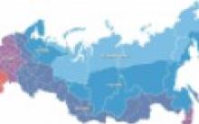
Determine from the maps of the atlas through what number of degrees the network is plotted on the physical map of the hemispheres. (through 10 or 20 degrees).
How many meridian parallels can be drawn through one point? (1 parallel and one meridian)
Horizontal 3. Distance north or south of the equator expressed in degrees(latitude)
Vertical 3. Distance west or east of the prime meridian, expressed in degrees.
Horizontal 4: A value that shows how many times the distance on the globe is reduced compared to the real one. (scale)
4 vertical: Reduced volume model of the Earth(the globe)
3. Learning new material.
3.1. The teacher's story with elements of conversation. The topic of today's lesson: "The purpose of the lesson. Lesson plan» (SLIDE 1-3).
3.2.
We got acquainted with one of the models of the Earth - a globe. However, its use for solving most practical problems is inconvenient. The main advantage of the globe - volume - this is also its disadvantage. To obtain a very detailed image of the earth's surface, the globes must be huge. Therefore, most often people use flat images of the Earth's surface. What is the best way to get it? We need to take a picture of the Earth from above. The Earth is photographed from airplanes, from orbital stations, airships. (SLIDE 3-10). A story about the aircraft, and the types of shooting.
3.3.
Geographical objects on space and aerial photographs are presented in an unusual form for us. Let's compare the features of the terrain image on the globe and satellite image. (SLIDE 11, 12). Work in pairs. (Annex 3)
Features of the image of the island of Madagascar
If you agree with the statement put +.
Small conclusion.
3.4. (SLIDE-14) Shooting the earth's surface from aircraft allows you to get a detailed image of all the details of the terrain. Space images are taken from satellites moving in orbits around the Earth. With the help of the Google Earth program, let's see how our planet looks like, in particular our microdistrict. (SLIDE-13). A story about the geoinformation program Google Earth. (We switch to the Google Earth geoinformation program.) Let's look at how our microdistrict looks like from an airplane flying at an altitude of 7.4 km, and from the ISS (altitude 351 km).
3.5.
Aircraft take pictures of the Earth. The height over which a satellite or an aircraft flies depends on the coverage of the area being filmed and the scale of the images. The higher the satellites fly from the Earth, the smaller the scale of the images and the detail of their image. (SLIDE -15)
Let's see what our neighborhood looks like filmed:
- an airship flying at a maximum altitude of 2500 m
- from the aircraft IL-14 flying at an altitude of 7400 m,
- from the satellite of the Don series located at an altitude of 306,
- from the Meteor weather satellite at an altitude of 625 km
-from the ISS board 351 km.
See what our microdistrict looks like from an extremely low altitude, the picture was taken from a helicopter flying over our microdistrict at an extremely low altitude. (SLIDE 15-21)
The bottom panel displays the height of the camera above the ground
All these devices have risen to the maximum height, which devices will have a larger-scale image, and which ones will have a smaller-scale one? Write down the aircraft in descending order of detail and scale of the images obtained by these devices. (Annex 4)(on a magnetic board, attach aircraft in the correct order )
3.6.
Recognition of objects in an image is called decryption. Let's try to recognize the main objects of our neighborhood. In the Planet Earth program, I will indicate the main objects with marks (MOU SOSH 24, Mail, Kindergarten, 26 TSNTI). (If possible, you can put each child at the computer.)
3.7.
In addition to our planet, there are pictures of other planets such as Mars. What can we tell about the planets by looking at their satellite images . (SLIDE 22 if the internet fails). Switch to Google Earth for the image of Mars.
Let's compare how these planets look in pictures from space.
They allow obtaining spatial information about the earth's surface in the visible and infrared ranges of electromagnetic wave lengths. They are able to recognize the passive reflected radiation of the earth's surface in the visible and near infrared ranges. In such systems, the radiation falls on the appropriate sensors that generate electrical signals depending on the intensity of the radiation.
In optical-electronic remote sensing systems, as a rule, sensors with constant progressive scanning are used. Can be distinguished linear, transverse and longitudinal scanning.
The total scanning angle across the path is called the angle of view, and the corresponding value on the surface of the Earth is called shooting bandwidth.
The part of the data stream received from the satellite is called the scene. Schemes for cutting the stream into scenes, as well as their size for different satellites, have differences.
Optoelectronic remote sensing systems conduct surveys in the optical range of electromagnetic waves.
Panchromatic images occupy almost the entire visible range of the electromagnetic spectrum (0.45-0.90 microns), therefore they are black and white.
Multispectral(multizone) imaging systems form several separate images for wide spectral bands ranging from visible to infrared electromagnetic radiation. The greatest practical interest at the moment is represented by multispectral data from new-generation spacecraft, including RapidEye (5 spectral zones) and WorldView-2 (8 zones).
Satellites of the new generation of high and ultra-high resolution, as a rule, are shooting in panchromatic and multispectral modes.
Hyperspectral shooting systems form images simultaneously for narrow spectral zones in all parts of the spectral range. For hyperspectral imaging, it is not the number of spectral zones (channels) that is important, but the width of the zone (the smaller, the better) and the sequence of measurements. So, a survey system with 20 channels will be hyperspectral if it covers the range of 0.50-070 μm, while the width of each spectral zone is not more than 0.01 μm, and a survey system with 20 separate channels covering the visible region of the spectrum , near, shortwave, mid and longwave infrared regions, will be considered multispectral.
Spatial resolution— a value that characterizes the size of the smallest objects distinguishable in the image. The factors affecting the spatial resolution are the parameters of the optoelectronic or radar system, as well as the height of the orbit, that is, the distance from the satellite to the object being photographed. The best spatial resolution is achieved when surveying at nadir, while deviating from nadir, the resolution deteriorates. Satellite images can have low (more than 10 m), medium (from 10 to 2.5 m), high (from 2.5 to 1 m), and ultra-high (less than 1 m) resolution.
Radiometric resolution is determined by the sensitivity of the sensor to changes in the intensity of electromagnetic radiation. It is determined by the number of gradations of color values corresponding to the transition from the brightness of absolutely "black" to absolutely "white", and is expressed in the number of bits per pixel of the image. This means that in the case of a radiometric resolution of 6 bits / pixel, we have a total of 64 color gradations, 8 bits / pixel - 256 gradations, 11 bits / pixel - 2048 gradations.
The globe quite accurately displays the outlines of the land of the Earth, but it is not always convenient to use it. It is more practical to give an outline of the Earth and its parts on a plane, paper.
Consider in the atlas the image of the Earth's surface - a drawing and a plan of the area (Fig. 14, 15), an aerial photograph (Fig. 16), a satellite image (Fig. 17) and a geographical map (Fig. 18). How do they differ from each other?
aerial view - this is a photograph of the area, which is taken from an airplane or other aircraft using a special aerial camera in the appropriate scale.
An aerial photograph is used during geographical and geological research, engineering search work, as well as in the preparation of topographic maps.
space shot - this is a photograph of the earth's surface or the entire planet, which is made by automatic photographic equipment from artificial satellites of the Earth.
Satellite images made it possible to compile maps of a new type (space photo maps). On their basis, such a branch of science as space cartography is developing. In particular, there are detailed maps of the Moon, Venus, Mercury, Mars. On the terrain plan, all objects and objects are reproduced by generally accepted conventional signs.
Terrain plan - This is an image of a small area of \u200b\u200bthe area using conventional signs and on a scale.
 |
| Rice. 16. Aerial photograph of the area |
 |
| Rice. 17. Space shot |
On a geographical map, as well as on a local plan, objects are also shown by conventional signs.
Geographic map - this is an image of the necessary territory or the entire planet with the help of conventional signs and on a certain scale.
The set of conventional signs and their explanations are called map legend. All types of conventional signs are divided into contour, off-scale, linear. Outline signs convey the actual dimensions of the object, consist of a contour filled with color or hatching. For example, a forest, a swamp, a lake - on a terrain plan, mountains, plains, contours of continents - on a geographical map . off-scale signs as geometric shapes, symbols, drawings show objects that cannot be marked on the scale of a plan or map. For example, a spring, a well, a school on a local plan, signs of minerals and settlements, mountain peaks . Linear signs they transmit linear objects on the plan and map: roads, rivers, borders, etc. On the scale, only their length is shown, but not the width. Depending on the size of the depicted territory and the size of the map itself, different scales are used. The smaller the territory and the more details in its reproduction, the larger the scale of the map. It is called large-scale. Plans of the area have such a scale (1: 5000 and more). There are large scale topographic maps(from 1:5000 to 1:200000) (Fig. 19). On fig. 19 - the scale is larger, and in fig. 18 is less. On such maps, a small territory is depicted in detail. They are used in military affairs, construction, when laying roads, in agriculture, hiking, etc. Maps with a scale of 1:200,000 to 1:1,000,000 are called medium scale(Fig. 20).
 |
| Rice. 18. Physical map |
 |
| Rice. 19. Topographic map (scale 1: 10,000) |
But most often a person needs to show on the map the vast territories of the continents, individual countries or their regions, and sometimes the entire planet. Then a small scale is used, and the maps are called small scale(Fig. 21). Maps of school atlases, wall maps - small-scale. For example, the scale of the map of the hemispheres in the school atlas is 1:90 000000 (900 km in 1 cm), the map of Ukraine is 1:6 000000 (60 km in 1 cm). Note that the scale of the first map is smaller, and the second one is larger.
On the plan and map it is impossible to show all the smallest objects on the ground. They would make it difficult to read the images. Therefore, only the main ones are applied to the plan and map, i.e. the image is summarized. The smaller the scale of the map, the greater the generalization. material from the site
Plan and map - This is a reduced image of the earth's surface on a plane, made to scale.
Geographic maps depicting natural objects (continents, oceans, mountains, plains, rivers, lakes, etc.) are called physical. For example, physical map hemispheres, physical map of Ukraine.
There are several types of images of the Earth or its individual sections: a globe, a plan of the area, a geographical map, a drawing, an aerial photograph, a satellite image.
On this page, material on the topics:
What is the difference between an aerial photograph and a plan of the area
What is the difference between a plan of the area and a picture from space
What is the difference between a satellite image and an aerial photograph?
Space image of the area at a scale of 1: 5000 photos
Questions about this item:


For beginners: breeding a broiler at home Boiled water for broilers
Only lovers will survive
Features of advertising aimed at children
retouching old photos in photoshop retouching old photos
What is an NPO: decoding, definition of goals, types of activities Does a non-profit organization have the right