Platforms of the lithosphere
Platforms are relatively stable areas of the earth's crust. They arise on the site of previously existing highly mobile folded structures, formed during the closure of geosynclinal systems, by their successive transformation into tectonically stable areas.
A characteristic feature of the structure of all lithospheric platforms of the Earth is their structure of two tiers or floors.
The lower structural floor is also called the foundation. The foundation is composed of highly deformed metamorphosed and granitized rocks, penetrated by intrusions and tectonic faults.
According to the time of formation of the foundation, the platforms are divided into ancient and young.
The ancient platforms, which also make up the core of modern continents and are called cratons, are of Precambrian age and formed mainly by the beginning of the Late Proterozoic. Ancient platforms are divided into 3 types: Laurasian, Gondwana and transitional.
The first type includes the North American (Lawrence), East European and Siberian (Angaris) platforms, formed as a result of the breakup of the supercontinent Laurasia, which in turn was formed after the breakup of the Pangea protocontinent.
To the second: South American, African-Arabian, Hindustan, Australian and Antarctic. The Antarctic platform before the Paleozoic era was divided into the Western and Eastern platforms, which united only in the Paleozoic era. The African platform in the Archaean was divided into the Congo (Zaire), Kalahari (South African), Somalia (East African), Madagascar, Arabia, Sudan, and Sahara protoplatforms. After the collapse of the Pangea supercontinent, the African protoplatforms, with the exception of Arabian and Madagascar, united. The final unification took place in the Paleozoic era, when the African platform turned into the African-Arabian platform as part of Gondwana.
The third intermediate type includes small platforms: Sino-Korean (Huanhe) and South China (Yangtze), which at different times were both part of Laurasia and Gondwana.
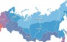
Fig.2 Platforms and geosynclinal belts of the lithosphere
Archean and Early Proterozoic formations participate in the foundation of ancient platforms. Within the South American and African platforms, some formations belong to the Upper Proterozoic time. The formations are deeply metamorphosed (amphibolite and granulite facies of metamorphism); the main role among them is played by gneisses and crystalline schists, granites are widespread. Therefore, such a foundation is called granite-gneiss or crystalline.
Young platforms formed in the Paleozoic or Late Cambrian time, they border the ancient platforms. Their area is only 5% of the total area of the continents. The foundations of the platforms are composed of Phanerozoic sedimentary-volcanic rocks that experienced weak (greenschist facies) or even only initial metamorphism. There are blocks of more deeply metamorphosed ancient, Precambrian rocks. Granites and other intrusive formations, among which ophiolite belts should be noted, play a subordinate role in the composition. In contrast to the foundation of ancient platforms, the foundation of young ones is called folded.
Depending on the time of completion of the basement deformations, the division of young platforms into Epibaikalian (the most ancient), Epicaledonian and Epihercynian.
The first type includes the Timan-Pechora and Mysian platforms of European Russia.
The second type includes the West Siberian and East Australian platforms.
To the third: the Ural-Siberian, Central Asian and Ciscaucasian platforms.
Between the basement and the sedimentary cover of young platforms, an intermediate layer is often distinguished, which includes formations of two types: sedimentary, molasse or molasse-volcanic filling of intermountain depressions of the last orogenic stage in the development of the mobile belt that preceded the formation of the platform; detrital and detrital-volcanic filling of grabens formed at the stage of transition from the orogenic stage to the early platform
The upper structural stage or platform cover is composed of non-metamorphosed sedimentary rocks: carbonate and shallow sandy-clayey in platform seas; lacustrine, alluvial and bog in a humid climate on the site of the former seas; eolian and lagoonal in arid climate. The rocks occur horizontally with erosion and unconformity at the base. The thickness of the sedimentary cover is usually 2-4 km.
In a number of places, the sedimentary layer is absent as a result of uplift or erosion, and the foundation comes to the surface. Such sections of platforms are called shields. On the territory of Russia, the Baltic, Aldan and Anabar shields are known. Within the shields of ancient platforms, three complexes of rocks of the Archean and Lower Proterozoic age are distinguished:
Greenstone belts, represented by thick sequences of regularly alternating rocks from ultrabasic and basic volcanics (from basalts and andesites to dacites and rhyolites) to granites. Their length is up to 1000 km with a width of up to 200 km.
Complexes of ortho- and para-gneisses, which, in combination with granite massifs, form fields of granite-gneisses. Gneisses correspond in composition to granites and have a gneiss-like texture.
Granulite (granulite-gneiss) belts, which are metamorphic rocks formed under conditions of medium pressure and high temperatures (750-1000 ° C) and containing quartz, feldspar and garnet.
Areas where the foundation is covered everywhere by a thick sedimentary cover are called slabs. Most of the young platforms are sometimes referred to simply as slabs for this reason.
The largest elements of the platforms are syneclises: vast depressions or troughs with slope angles of only a few minutes, which correspond to the first meters per kilometer of movement. As an example, we can name the Moscow syneclise with its center near the city of the same name and the Caspian syneclise within the Caspian lowland. In contrast to syneclises, large platform uplifts are called anteclises. On the European territory of Russia, the Belarusian, Voronezh and Volga-Ural anteclises are known.
Grabens or aulacogens are also large negative elements of the platforms: narrow, extended sections, linearly oriented and limited by deep faults. There are simple and complex. In the latter case, along with deflections, they include uplifts - horsts. Effusive and intrusive magmatism is developed along the aulacogenes, which is associated with the formation of volcanic covers and explosion pipes. All igneous rocks within the platforms are called traps.
Smaller elements are shafts, domes, etc.
Lithospheric platforms experience vertical oscillatory movements: they rise or fall. Such movements are associated with the transgressions and regressions of the sea that have repeatedly occurred throughout the entire geological history of the Earth.
In Central Asia, the formation of the mountain belts of Central Asia: Tien Shan, Altai, Sayan, etc. is associated with the latest tectonic movements of the platforms. Such mountains are called revived (epiplatforms or epiplatform orogenic belts or secondary orogens). They are formed during orrogenesis epochs in areas adjacent to geosynclinal belts.
The platform is a relatively stable block of continental crust. Platforms are vast sedentary areas of the earth's crust - the most stable blocks that create its solid frame. The structure of the platforms over most of their area is characterized by a two-tier structure: at the base lies an intensely deformed, metamorphosed and granitized basement, unconformably overlain by a sedimentary, in places with the participation of volcanic covers, cover that occurs subhorizontally and is not affected by metamorphism. The platform has a powerful foundation of folded-metamorphosed rocks, cut through by numerous intrusions and covered with sedimentary rocks of different thickness - a cover or upper tier. The sedimentary cover covers deep depressions of the lower stage (syneclise) up to 2-6 km deep. and anteclises approaching almost to the surface. It consists of horizontally lying or crumpled into gentle folds by subsequent tectonic movements already above the basement of layers of marine or continental origin. In places, the folded-metamorphic basement rises above the sedimentary cover in the form of shields (the Baltic Shield on the East European Platform). Thus, crystalline shields are distinguished within the platform, in which the ancient metamorphosed basement comes to the surface and areas where the basement is covered with a slightly deformed sedimentary cover. Such tectonic regions used to be called plates, but are now more commonly referred to simply as platforms.
Platforms with a Precambrian basement are called ancient; they make up, as it were, the cores of modern continents (except for Asia, in which 4 platforms are known) and are considered by many scientists as fragments of one continental mass "Pangea", formed by the middle of the Proterozoic (1700 million years). Platforms with a younger (Paleozoic - early Mesozoic) basement are known as young; they are located on the periphery of ancient platforms or fill the gaps between them (the West Siberian young platform between the ancient East European and Siberian ones).
14.1.3 1. What is a mineral? His structure. Classification
A mineral is a natural substance consisting of one element or a regular combination of elements, formed as a result of natural processes occurring in the depths of the earth's crust or on the surface. Each mineral has a specific structure and has its own physical and chemical characteristics. Currently, more than 2,500 minerals are known (not counting varieties). The science that studies minerals is called mineralogy.
Depending on the state of aggregation, minerals are divided into solid (quartz), liquid (mercury), gaseous (methane). The most widespread are solid minerals, among which, in turn, crystalline minerals predominate (the atoms in them are arranged in an orderly manner), and amorphous ones (with a chaotic arrangement of atoms) are much less common..
Most minerals have a certain chemical composition. Although the impurities included in them are capable of influencing the physical properties of minerals or even changing them, they are usually not mentioned in chemical formulas. When determining minerals, the shape of their crystals plays a very significant role. And although in the samples it is not always ideally expressed, but more often simply distorted, nevertheless, in most cases, it is possible to distinguish any signs of the crystalline structure - faces, shading, or constant angles between faces.
Typical forms of crystals are combined into seven crystallographic systems called syngonies. The distinction between them is made along the crystallographic axes and the angles at which these axes intersect.
There are the following crystallographic syngonies (systems): cubic (regular), tetragonal (square), hexagonal (hexagonal), trigonal (rhombohedral, or triangular), rhombic (sometimes called orthorhombic), monoclinic and triclinic.
The factors that determine the shape of a mineral are the structure of its crystal lattice and the packing of atoms, ions or molecules. If at the same chemical composition Since the atoms themselves are always identical, their mutual arrangement can differ significantly. The structure of the crystal lattice determines not only the shape of the crystals, but also their cleavage. So, for example, with a helical arrangement of particles in a lattice that does not allow flat interfaces to be held in it, the crystal does not split along cleavage (that is, it does not have cleavage)
End of work -
This topic belongs to:
Structure, tasks of geology, its role in the construction industry
In construction practice, any rocks and soils are called soils. Soil is a mineral or organomineral dispersed phase .. and rocks that are located in the upper part of the lithosphere and are .. analyzed to select the optimal design solutions for the placement of structures and production methods ..
If you need additional material on this topic, or you did not find what you were looking for, we recommend using the search in our database of works:
What will we do with the received material:
If this material turned out to be useful for you, you can save it to your page on social networks:
| tweet |
All topics in this section:
History of the development of geology. Milestones of development
As a science, historical geology began to take shape at the turn of the 18th and 19th centuries, when W. Smith in England, and J. Cuvier and A. Brongniard in France came to the same conclusions about the successive change of layers and
What are the tasks of engineering geology in construction
In the process of engineering and geological research, information is collected about the physical and geographical situation, climate, vegetation, wildlife, experience in the construction and operation of structures, economic
Methods used in engineering geology
With the help of geophysical methods, a number of important engineering-geological problems can be solved. When conducting engineering and geological studies, they often use:
The main technological sequence of designing structures
Engineering and geological surveys are needed to determine the features of the geological structure of the construction site. Survey work includes drilling wells, sampling
What hypotheses about the origin of the Earth do you know?
Kant-Laplace hypothesisThey believed that the progenitor of the solar system is a hot gas-dust nebula, slowly rotating around a dense core in the center. Under in
Describe the structure of the globe and its outer and inner shells
The structure of the globe was the result of complex processes occurring both in the depths of the Earth and on its surface. The earth has the shape of a geoid (Greek ge - earth, eidos - view), i.e. a ball, several
What does paleontology study
Paleontology (from other Greek παλαιοντολογία) is the science of the fossil remains of plants and animals, trying to reconstruct
What does geotectonics study
Geotectonics is a branch of geology, the science of the structure, movements and deformations of the lithosphere, of its development in connection with the development of the Earth as a whole. Geotectonics is the theoretical core of all geology[
The main features of the relief of the earth's surface
The most characteristic feature of the face of the Earth is the antipodal, i.e., opposing, arrangement of oceanic and continental spaces. The antipodes of the continents on one side of the globe are the oceans on the other side of the globe.
Major tectonic structures
Tectonic structures - These are large areas of the earth's crust, limited by deep faults. The structure and movements of the earth's crust are studied by the geological science of tectonics. As you already know, croup
Tectonic movements of the earth's crust
Tectonic disturbances are called movements of the matter of the earth's crust under the influence of processes occurring in the deeper bowels of the Earth. These movements cause tectonic disturbances, i.e. changes
How reservoir occurrence elements are determined
The elements of occurrence of geological boundaries (strata, bedding surfaces and unconformities, tectonic) cannot always be measured in outcrops. They can be identified: by the visible slopes in the naked
Folds and their elements
Among the folds, elementary types of folds are distinguished - anticlinal and synclinal, neutral, as well as antiforms and synforms. Anticlinal folds or anticlines are called
Fold elements
The following elements are distinguished in the fold - a lock or vault, wings, an axial surface, an axial line or an axis of the fold, a fold hinge, a ridge and a keel, a ridge and a keel surface, an inflection line and
Types of discontinuous and non-discontinuous faults (dislocations)
Breakdown violations. There are three main types of discontinuous disturbances that affect the formation of the landscape structure of the territory. In the first case, a weakened
List the main properties of minerals
For a long time, the main characteristics of minerals were the external shape of their crystals and other precipitates, as well as physical properties (color, luster, cleavage, hardness, density, etc.)
List the processes of mineral formation
PROCESSES OF MINERAL FORMATION - physico-chemical. processes occurring in the earth's crust and causing the formation, change and destruction of materials. The classification of P. m is based, on the one hand, on the source of
The most important rock-forming minerals
Among great variety natural minerals, only a small part of them is involved in the formation of rocks. These minerals, called rock-forming minerals, include quartz, feldspars,
What is the Mohs scale for?
To measure the hardness of minerals, attempts were made to apply all sorts of methods based on the resistance of stones to scratching, abrasion, drilling, surface deformation ... But all these attempts did not
Engineering - geological features of igneous and metamorphic rocks
Engineering and geological features of metamorphic rocks Physical and mechanical properties of metamorphic rocks are in many respects close to magmatic
What forms of intrusive bodies do you know
Theoretically, intrusive bodies come in any size and any shape, but usually they can be attributed to one of the varieties, characterized by a certain size and shape. Dikes - pla
What types of metamorphism do you know
Metamorphism is a complex physical and chemical phenomenon due to the complex effects of temperature, pressure and chemically active substances. It flows without existence
What factors determine metamorphism
Metamorphism is the transformation of rocks under the influence of endogenous processes that cause changes in the physicochemical conditions in the earth's crust. Any rocks can be transformed - o
What metamorphic rocks do you know
Metamorphic rocks are the result of the transformation of rocks of different genesis, leading to a change in the primary structure, texture and mineral composition in accordance with the new physical and chemical
Rocks of biochemical origin
Breeds of biochemical origin. Depending on the composition, siliceous (tripoli, flasks, some jaspers), carbonate (limestones, dolomites, marls) and phosphate rocks are distinguished.
Physical properties of soils. Indicators of the physical properties of soils. Methods for their determination
physical properties of soils: density, moisture, strength, cohesion, lumpiness, looseness, angle of repose and erosion. Density p is the ratio of the mass of soil, vk
Soil density, main indicators
Density p is the ratio of the mass of soil, including the mass of water in its pores, to the volume occupied by this soil. Density of sandy and clay soils - 1.5...2 t/m3; semi-rocky unbroken
The main properties of clay rocks
The special properties of clay rocks are largely determined by the crystal-chemical features of clay minerals and their high dispersion (that is, an extremely small particle size). Most tee
Mechanical properties of soils. General presentation, indicators of deformation and strength properties
Mechanical properties are those that have a decisive influence on the deformation and strength of the soil under load. Soil deformations under load are accompanied by complex processes: compression
Determination of soil shear resistance. Coulomb formula. Devices. Construction of graphs. Shift Passport
Shear resistance of soils is their most important strength indicator. It is necessary for calculating the stability and strength of the foundations, assessing the stability of slopes, calculating the pressure of soils on the ground
Which rock is the strongest
Deep rocks (igneous) are characterized by high density, frost resistance, and low water absorption. The main types of deep rocks are granites, syenites, gabbro, labra-dorites
Physical and chemical properties of soils, their importance in construction practice. Thixotropy
Physical properties: First of all, the physical properties include: specific and volumetric mass, as well as the duty cycle (porosity) of soils. The ratio of the solid phase of dry soil to the weight of an equal volume of water p
Soil as a multiphase system. The nature of the structure of bonds in the soil
Dispersed soils are a multiphase system. They consist of two or more substances distributed one within the other. An example of such a system is a clay slurry consisting of
Rock mass as an object of engineering and geological research
Based on the engineering-geological data of the rock mass, the optimal design solutions for the development of the field are chosen, and therefore the costs of engineering-geological work are justified
When interacting with engineering structures
Depending on the mining and geological conditions and the nature of the planned mining operations, the behavior and properties of the rocks of the massif are approximately displayed by the mechanical laws of various idealizations.
Fracture assessment, control measures
The degree of rock fracturing, together with other tectonic disturbances, characterizes the structure of the rock mass, its spatial heterogeneity and anisotropy of properties. It influences the
Criteria for assessing the degree of fracturing
The criterion for quantifying the degree of fracturing is chosen indicators that take into account the size and density of cracks. There are three types of indicators: linear
Types of cracks
Cracks are flat discontinuities in a continuous medium if their size exceeds the interatomic distances in the crystal lattice by an order of magnitude or more. There are three types of cracks:
Fracture characteristics
The correct choice of the development system and drilling and blasting parameters depends on the degree of fracturing. In the old days, fracturing was assessed by the acoustic method, hitting the rock with a hammer and listening
Theories of the origin of groundwater
1. Infiltration theory. Basic provisions: groundwater comes from atmospheric precipitation, which penetrates into the ground through the smallest channels of rocks, where it accumulates, which happens
Underground and surface runoff
Surface runoff, the process of movement of water on the earth's surface under the influence of gravity. Surface runoff is divided into slope and channel runoff. Slope runoff is formed from
Physical properties of groundwater
According to GOST, the physical properties of groundwater also include density, viscosity, electrical conductivity, radioactivity, etc. Water density is the mass of water, nah
Main chemical components of groundwater
ion-salt composition. Groundwater is not found in a chemically pure form. More than 60 elements of the periodic system of Mendeleev were found in it. The main components (ions) that determine chemically
Aggressiveness and hardness of groundwater
Most often, water analyzes are performed on samples where the total amount of dissolved solids is only a small fraction of one percent of total weight water samples. Therefore, the mineralization of water
Kurlov formula
Kurlov, 1921, is a pseudo-formula that clearly depicts the main properties of chemical. comp. water. Anions are written in the numerator of the fraction, cations present in an amount of more than 5% equivalent are written in the denominator. (based on
unloading
The upper part of the earth's crust lying above the groundwater level is called the zone of temporary water content or aeration zone. The aeration zone is measured from 0 (swamps) to 50-100 (deserts) of the feeding zone
unloading
Ground waters are called free waters of the first permanent aquifer from the surface, which lies in the zone of complete saturation. The area of groundwater recharge, as a rule, coincides
Maps of hydroisogypsum and hydroisobaths. Their analysis
Hydroisogypse map - a map that displays the position of the groundwater table in the form of hydroisohypses. HYDROISOBATHS - lines connecting on the plan (map) the points of the groundwater mirror located
Unloading Elements of artesian basins. Hydroisopiesis maps
Artesian groundwater is called pressure groundwater, located in permeable (porous, fractured, karst) layers, covered and underlain by impermeable rocks. These waters are everywhere
Name the water and physical properties of rocks
Under water properties rocks are understood as those that appear in them when interacting with water: water permeability, moisture capacity, water loss, natural moisture, swelling, soaking,
uplift, water loss, water absorption, water saturation
One of the main properties of the rock, which determine its relationship to water, is porosity and off-duty ratio. Under porosity is understood the presence in the rocks of small voids - capillary pores, under the duty cycle - n
Porosity, density, moisture
Physical Properties characterize the physical state of rocks, i.e. qualitative certainty, manifested in their density, moisture, porosity, fracturing and weathering under conditions
Name the types of water in rocks
1) Water in the form of steam. This type of water is present in the air that fills the cracks and voids between rock particles. 2) Water in the form of ice. Ice in soils and rocks
Traffic. Darcy formula. What is the difference between laminar and turbulent
groundwater movement? The rate of movement (filtration) of groundwater is characterized by Darcy's law "The amount of water Q that has passed through any section F per unit time
Methods for determining the filtration coefficient (CF)
1) filtration devices in laboratories The filtration coefficient k is determined in the laboratory on a special installation in which a sample of the test soil is placed.
galleries, etc.). Name how water intakes differ by the nature of the opening
Horizontal water intakes are used at a shallow depth of the aquifer (up to 5 - 8 m) and its low thickness. They are drainage pipes or galleries (Fig. 4) placed in
Power, current lines, equal pressure lines, speed, flow
Head - the value of liquid pressure, expressed by the height of the liquid column above the selected reference level; measured in linear units. PRESSURE GRADIENT
Main types
[edit] Reservoir drainage The reservoir drainage system is laid at the base of the protected structure directly on the aquifer. At the same time, it is hydraulically connected
The concept of the depression funnel and the radius of influence
When pumping water from wells, due to the friction of water on soil particles, a funnel-shaped decrease in the water level occurs. A depression funnel is formed, which in plan has a shape close to a circle.
Factors determining the development of geological and engineering-geological processes and phenomena
Exogenous (from the Greek éxo - outside, outside) are called geological processes, which are caused by energy sources external to the Earth: solar radiation and the gravitational field.
Endogenous engineering-geological processes and phenomena. general characteristics
Endogenous (internal) processes are called such geological processes, the origin of which is associated with the deep bowels of the Earth. The substance of the globe develops in all its
What is called an earthquake, hypocenter, epicenter
Earthquakes - tremors and vibrations of the Earth's surface caused by natural causes (mainly tectonic processes), or (sometimes) artificial
Seismic waves and their measurement
Sliding of rocks along the fault is initially prevented by friction. As a consequence, the energy that causes movement accumulates in the form of elastic stresses in the rocks. When the voltage reaches the critical
Types of seismic waves
Seismic waves are divided into compression waves and shear waves. § Compression waves, or longitudinal seismic waves, cause vibrations of rock particles through which they pass, vd
Man-made earthquakes
Recently, there have been reports that earthquakes can be caused by human activities. So, for example, in areas of flooding during the construction of large reservoirs, tectonic
Magnitude scale
The magnitude scale distinguishes earthquakes by magnitude, which is a relative energy characteristic of an earthquake. There are several magnitudes and, accordingly, magnitudes
Intensity scales
Main article: Earthquake intensity Intensity is a qualitative characteristic of an earthquake and indicates the nature and extent of the impact
What are the main factors of weathering and what are the zones of the weathering crust of the full profile
Weathering, the process of destruction and change of rocks under the conditions of the earth's surface under the influence of the mechanical and chemical effects of the atmosphere, ground and surface waters and organisms. P
What is evolution, deluvium, proluvium, colluvium, alluvium. Their engineering geological features
Eluvium (eluvial deposits) (lat. eluo - “wash out”) - loose geological deposits and soils formed as a result of weathering of surface rocks in place
River valleys. river erosion. Erosion basis
Valley (river) - a negative, linearly elongated landform with a uniform fall. It is usually formed as a result of the erosive activity of flowing water. River in
Linear erosion
Unlike surface erosion, linear erosion occurs in small areas of the surface and leads to the dismemberment of the earth's surface and the formation of various erosion forms (gullies, ravines, gullies
Mudflow processes, their division
According to the mechanism of movement, mudflows can be divided into two types. Type 1 - connected (“mud” and “mudstone”) flows with a predominance of viscous flow. Type 2 - incoherent ("water-stone") flows
Karst development
Negative landforms are most characteristic of karst. By origin, they are divided into forms formed by dissolution (surface and underground), erosive and mixed. By morph
The concept of suffusion, quicksand, cause of occurrence, control measures
Suffosia (from lat. suffosio - digging) - the removal of small mineral particles of rock by water filtering through it. The process is close to karst, but differs from it in that
True quicksand
Often quicksand properties are exhibited by silty sands and sandy loams saturated with water, containing in large numbers very small particles (clay and colloidal), which begin to play the role of lubricating
False quicksand
False quicksand - fine porous sand saturated with water. Since the reservoir is at a depth, the water in the pores of the quicksand is under pressure greater than atmospheric pressure. When opening the layer is exposed, and water
Engineering-geological assessment of permafrost
The distribution of frozen strata is subject to latitudinal and altitudinal zonality. According to the average annual temperatures, the nature of distribution and thickness, five zones are distinguished on permafrost. continuously
Stress state of rocks
The stress state of the earth's crust characterizes not only the surface layers themselves, which can be observed directly, but also the deeper parts of the earth's crust, and the magnitude of the stress is
What are the criteria for assessing the engineering-geological conditions of the area
Engineering-geological surveys. 1 collection and processing of materials of previously completed work; 2 field work(drilling and testing of wells, field studies of soils); 3 hydrogeological
Mapping requirements. Reading geological sections and maps
A geological map showing the horizontal occurrence of rocks has its own characteristics: the youngest rocks occupy the highest parts of the terrain (mountain peaks),
Construction and analysis of hydroisohypse maps
Determination of underground flow rate
The calculation is made according to the map of hydroisohypses, built according to the data of level measurements in wells, in places where springs come out a) H1 = h1 and H2 = h2 b)
The practice of building a map of hydroisohypses according to borehole data
The supply of groundwater at the expense of surface water occurs everywhere (the level of surface and groundwater varies depending on the time of year). As a result, between superficial
Construction and analysis of engineering-geological sections. Building practice
Engineering-geological sections (profiles) - a widely used form of graphic processing and generalization of information, characterizes engineering-geological and hydrogeological conditions
Building a geological column of a well drilled within a geological map
To build a geological column of a well, descriptions of boreholes drilled within a geological map are used. To build a geological column, for example, well No. 6,
Stages of engineering and geological surveys for construction
Engineering surveys are an important part of building design. As a result of a set of measures, the necessary data on the natural conditions of the area where construction is planned are received.
Modern methods of research and processing of engineering-geological information
To receive, accumulate, store and process engineering-geological information, they use various methods, which should be divided into methods: obtaining information - M11
Geotechnical sampling methods and sampling sequence
Engineering-geological testing - a method that includes methods for determining the volume and parameters of sppinfs, methods for sampling soils and their conservation. This method, together with other methods (
A platform in geography is a large area of the continental crust, characterized by a relatively calm tectonic regime. Platforms arise in areas formed during the closure of geosynclinal systems by their successive transformation into tectonic areas of a stable type. It is known that platforms in geography are part of lithospheric plates. They consist of lower and upper tiers. Below is the foundation, or slab. According to the time of formation, they are divided into young and ancient.
Platform structure
In geography, a platform is the foundation of the earth's crust about fifty kilometers thick. These formations are divided into two parts: below is the lower floor, i.e. the foundation of the platform, and above is the cover of the platform, or the upper, young layer. Between these layers there is a boundary called the intermediate structural layer. In different areas, it has a different thickness. The platforms themselves may not have a platform cover.
Platform types
All earthly platforms are divided into young and ancient. The latter occupy about forty percent of the total area of the continents. It is the ancient platforms that form the continents. Young platforms are characterized by the presence of a structural stage. This species occupies about six percent of the total area of the continents. Young formations are located either between ancient lithospheric plates, or along their edge.

Structural elements
In geography, a platform is a formation that has certain structural elements of a different order. The zones of the first order include:
- Shields.
- Plates.
- Lumps.
- Zones of pericratonic subsidence.
And in second-order geography, which species are classified as such? This group includes:
- Anteclise.
- Syneclise.
- Aulacogens.
Shields are a large area of platform foundation. This type of formation is typical for ancient platforms. Those parts that have relatively recently formed from under the foundation cover are called blocks.

Another structural element of the platform is the slab. It is an area of continuous development of the platform (sedimentary) cover. Young platforms are most often covered with a sedimentary cover, which is why they are often called slabs rather than platforms. Examples of these are the Scythian, East Australian plates. Structural objects of the first order are represented by zones of pericratonic subsidence. These are plates, or deflections, the width of which is no more than three hundred kilometers. These elements are located along the edge of the platforms.
Anteclises and syneclises are structural elements of the second order. The former are large gentle uplifts within the plates. In these zones, the foundation lies at a depth of about one and a half kilometers. Syneclises are also large formations, but only depressions are located inside plates or on shields.
Stages of development
There are four stages of development in the formation of platforms.
- Cratonization is characterized by the predominance of uplifts and a rather strong final bottom. This stage is characterized by stratification of gabbro-anorthosite pluton and rapakivi granite.
- The second stage is aulacogenous. Most pronounced on ancient platforms northern regions.
- The third stage is slab. On ancient platforms, this stage covers the entire period of the Phanerozoic and Jurassic. This stage ends with a phase of tectonic-magmatic activation. It is during these periods that the magmatites characteristic of the platforms are formed.
- The fourth stage is epiplatform orogens.
First platforms
And in geography, what types of ancient formations are there? The most studied Precambrian types are East European and North American. Also worth noting are the Canadian and Baltic shields. In these places, ancient platforms have been found on large areas.
East European Platform
This platform covers the entire European part of Russia, the Crimea, the Caucasus, part of Poland, Germany, some countries of the Scandinavian Peninsula. On the East European platform, the Ukrainian and Baltic shields are distinguished, between which there is a huge Russian plate.
It occupies a large northwestern part. Karelia, the Kola Peninsula, Sweden and Finland are located on this territory. The ancient platform in some areas was formed three million years ago: these are the rocks of the Kola complex, preserved in a small area.

There are other complexes, but they less years. These are the Nizhnekarelsky, Verkhnekarelsky, Belomorsky and Yatuli complexes. These species are formed by different sedimentary rocks: sandstones, crystals, shales and siliceous formations. The thickness of these complexes can be different and reach two thousand meters. Occasionally there are volcanic rocks. All these complexes different age- approximately 2500-1600 million years. Scientists believe that it was during this period of time that the upper cover of the East European Platform was formed.


Only lovers will survive
Features of advertising aimed at children
retouching old photos in photoshop retouching old photos
What is an NPO: decoding, definition of goals, types of activities Does a non-profit organization have the right
Gleb Nikitin First Deputy